The city of Amsterdam is constructing a new metro line running from Central Station in the north going roughly south to Amsterdam Zuid (South). Hence the name Noord/Zuidlijn (or North/South Line in English). Drilling the metro tunnels under ground is challenging and controversial because the tunnels go straight under Amsterdam’s historic buildings.
To show the general public what is going on under ground a special ‘uitkijkpunt’ (viewpoint) has been made near station Rokin (one of the new metro stations).
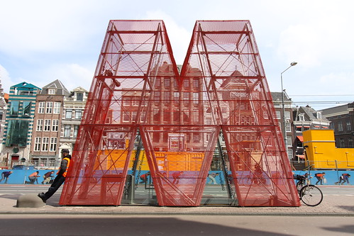
Entrance to the Noord/Zuidlijn uitkijkpunt.
This viewpoint is below ground. It gives an overview of what is going to be constructed, and a glimpse of the actual building process. Going down one level you arrive at some sort of exhibition area.
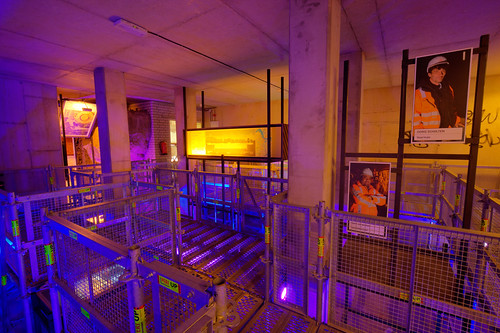
Exhibition area
This level and the one below will be part of an underground parking garage. The actual metro track will be 21.5 meters below NAP (see the end of this post for an explanation of NAP). The metro station will be 270 meters long, deepest point will be at 26.5 meters below NAP. The exhibition area is situated just below the M on the photo below.
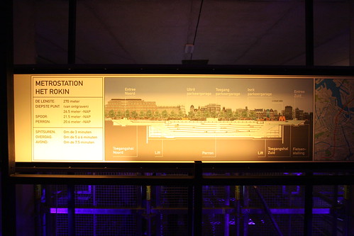
When you walk further, you can go down another level. This is the entrance to the working area.
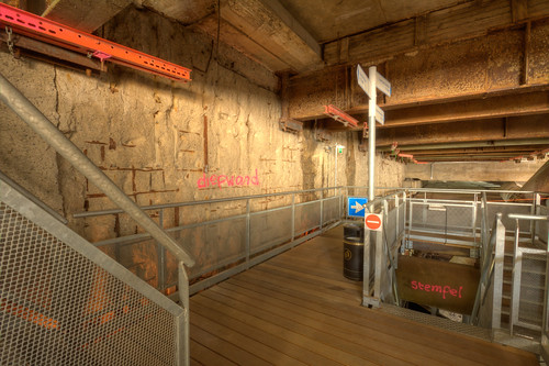
Entrance
The wall at the left (called ‘diepwand’) is the actual wall of the excavation. In the top right and bottom right you can see the ‘stempels’ – T-bars or tubes which run from one wall to the other wall. The ‘stempels’ provide support so the excavation does not collapse.
Going down another level you can see the place where the drilling takes place.
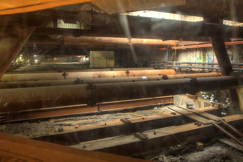
Upper level parking structure
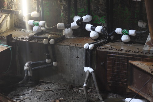
This will be the upper level of the parking structure. Here you can see the many ‘stempels’ which provide support for the outer walls of the excavation. Below this floor the metro tunnel will be drilled. To prevent the tunnel from collapsing during drilling, the earth will be frozen solid first, before drilling starts. In the lower right corner you can see the tubes which cool down the earth. Because the cooling process is already going on for several months ice has formed at the joints.
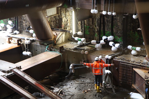
Unfortunately this is all you can see. You have to look through a metal grid or some perspex sheets in a wooden board to see something. The grid and wooden board limit what you can see.
Some comments on the photos
The exhibition area photo and the entrance photo are HDR photos composed of three photos (-2, 0, +2 stops exposed). The upper level parking structure photo is an HDR photos composed of 11 photos each 1 stop apart. I decided for such a large amount of photos because the sunlight can be seen in the top right of the photo, and it was pitch dark in the area just below. The photos were shot through a clear perspex sheet, so some streaks can be seen.
---
NAP
NAP stands for Normaal Amsterdams Peil (‘normal level of Amsterdam’) and is a reference level for all height measurements in the Netherlands. NAP is roughly the sea level at high tide.
Freezing the ground before drilling! Who knew? So "cool"! It must have been really cold down there. Thanks for showing it. And thanks for explaining how you made the composed HDR photos - 11 photos! Nicely done.
ReplyDelete